A little about the course for the race next Saturday (April 21, 2012). It is a beautiful (understatement) point-to-point 50 kilometer run, starting in Round Valley Regional Preserve and winding westward on the south side of Mount Diablo to finish in the Castle Rock Recreational Area (adjacent to Diablo Foothills Regional Park) in Walnut Creek.
I just worked a 12 hour Monday shift from hell (was there 13), made even more awful because we were with the one doctor in my group who won't allow music to be playing in the doctor's office, so I was going crazy. I can't begin to convey to you how much I'm really looking forward to this race. I can nonetheless try to convey some of the variety of scenery and natural beauty runners can enjoy and experience in a few hours.
The course has been changed since the first year so the GPS recording of my 2009 race is a bit differrent from the official race map and elevation chart. The elevation chart is presented not chronologically, but spatially/geographically, so you start on the right and end on the left, as if looking north.
I couldn't find any photos I've taken of Round Valley, but here is a link to a stunning photo by Marc Crumpler on flickr.
After a few miles in Round Valley, the Diablo Trail briefly passes through Los Vaqueros Reservoir...
 |
| Los Vaqueros Reservoir (different view than you get from the race, when you climb the hills in the background on this shot) taken running November 2007 |
...before ascending Miwok Trail into Morgan Territory Regional Preserve.
 |
| Mount Diablo and North Peak, from Morgan Territory |
 |
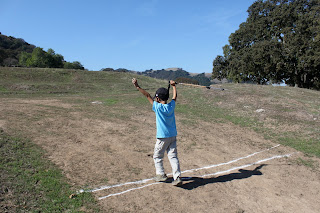
| Morgan Territory (actual part of the course) with my family, May 2011 |
.jpeg) |
| taken of me during 2009 race by Scott Hein |
From Morgan Territory, the trail enters Mount Diablo State Park around mile 16.5.
 |
| near Oyster Point, looking east (backwards for this race), March 2009 |
 |
| doing volunteer trail work with East Bay Trail Dogs, March 2009 |
The trail passes north of Rock City, a cool place to take your kids to climb on rocks (and freak out mommy). So, no we won't be running over these rocks.
 |
| April 2011 |
View continue of Mount Diablo (usually on the right), but the trail of course swerves.
 |
| taken from farther up the mountain last Halloween, when I saw my first Diablo tarantula on the trail |
The course (in contrast to the first year it was held) then does a backward "S" involving Stage, Burma and Wall Point roads (trails) before heading into Diablo Foothills Regional Park, including Little Yosemite,
 |
| View of Little Yosemite from Wall Point Rd. (mile 30), family hike January 2012 |
and finally into the finish line!


2 comments:
Looking forward to racing Diablo with you! Great photos.
Thanks, Tim. Looking forward to it too. I don't think we've run a race together since Antelope Island. But I think you will be too fast for us to hold hands.
Post a Comment